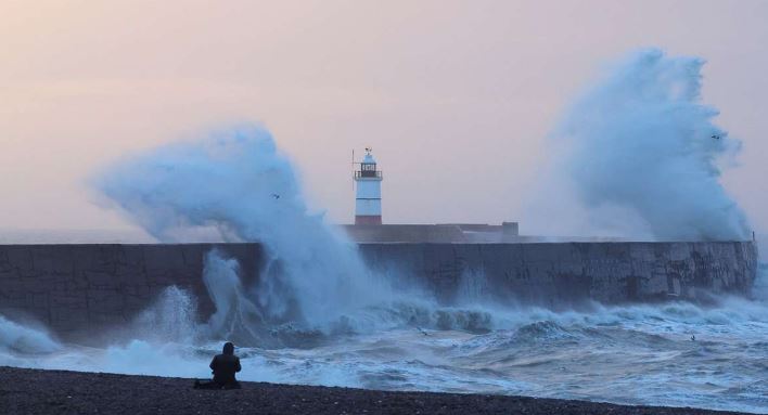
Scotland braces for Storm Éowyn, bringing winds of up to 90mph, heavy rainfall, and potential disruption across the UK this weekend.
Scotland is preparing for a weekend of turbulent weather as Storm Éowyn, the fifth named storm of the 2024-25 season, is set to unleash winds of up to 90mph. The Met Office has issued multiple yellow weather warnings for Friday and Saturday, warning of potential danger to life, property damage, and widespread disruption.
Storm Éowyn, pronounced “ay-oh-win,” will begin affecting the UK on Thursday evening, with conditions deteriorating rapidly through Friday. Forecasters have highlighted the risk of flying debris, large waves, and beach material being thrown onto coastal roads and properties, particularly in exposed areas of Scotland, Northern Ireland, and northern England.
Met Office Deputy Chief Meteorologist Mike Silverstone emphasised the storm’s intensity, saying, “The strongest gusts are likely to be felt across parts of Northern Ireland, northern England, northwestern Wales, and western Scotland, where exposed sites could get gusts in excess of 80mph.”
Forecasters have highlighted the risk of flying debris, large waves, and beach material being thrown onto coastal roads and properties, particularly in exposed areas of Scotland, Northern Ireland, and northern England.
Warnings and Expected Impacts
On Friday, two separate warnings cover northern and southern Scotland, with peak inland gusts of 60-70mph and coastal winds reaching 80-90mph in some areas. Angus, Grampian, and the Highlands and Islands are expected to face particularly severe conditions. A third warning on Saturday predicts similar gusts for the Northern Isles and coastal regions, alongside continued travel disruption.
Transport networks are likely to be heavily impacted, with road, rail, air, and ferry services facing delays and cancellations. Key roads and bridges may be closed due to safety concerns, and the RAC has cautioned drivers to remain vigilant.
“The wet and windy weather brought about by Storm Éowyn will make driving much more of a challenge towards the end of this week.” – RAC Breakdown
Alice Simpson, RAC Breakdown spokesperson, warned of the challenges for motorists: “Strong winds mean there’s a higher likelihood of fallen branches and trees on rural routes, which can obstruct journeys and puncture tyres. Drivers also need to be well aware of the buffeting effect of sudden gusts, especially along coastlines and exposed areas.”
A Sudden Change in Weather
The UK’s recent spell of calm, grey weather will come to an abrupt end as Storm Éowyn brings heavy rain and strong winds. Forecasters predict up to 30mm of rain in parts of western Scotland, England, and Wales, with snow possible over high ground in northern regions before milder air sets in.
The dramatic shift in conditions is linked to a powerful jet stream driven by extreme temperature contrasts across North America. This has intensified low-pressure systems, steering them across the Atlantic towards the UK.
Community Preparedness and Safety
The Met Office has urged residents to stay updated with the latest forecasts and take precautions. Andrea Bishop, a Met Office spokesperson, stated, “Storm Éowyn will bring a period of very unsettled, potentially disruptive weather to the UK through Friday and into Saturday.”
The public is advised to secure loose outdoor items, avoid unnecessary travel during peak winds, and prepare for possible power outages. Coastal residents should remain vigilant for large waves and potential flooding.
Looking Ahead
While Storm Éowyn is expected to weaken as it moves northeast, strong winds will persist into Saturday, with drier conditions for many areas. However, forecasters are monitoring another low-pressure system that could bring further wet and windy weather by Sunday, potentially extending the disruption into next week.
The Met Office has assured the public that additional updates will be provided as the situation develops. For now, the UK braces itself for a weekend dominated by Storm Éowyn, with Scotland bearing the brunt of its power.
As communities prepare for the storm’s arrival, the emphasis remains on safety, resilience, and vigilance during what promises to be one of the most challenging weather events of the season so far.


